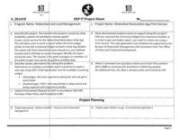
Watershed Restoration App Print Service
Description
Create a print service for the Watershed Restoration Web App. This print service will print a report developed in ArcGIS Pro that will be linked to the layers shared in the Watershed Restoration App. This report will show intersected layers based on a user defined location and it will help our grant managers identify GIS layers around an area. The mission is for grant managers of the public to gain easy access to publicly available data.This project will not involve storage or access to Personal Identifiable Information (PII).
App at:
https://experience.arcgis.com/experience/34bb67fb3a634cd4bdfd7aca35600aa3/
Project Justification
None
Attachments
Activity
Show:
Idea
Add watchers
Details
Sponsoring Leadership Area
Watershed and Land Management
Sponsoring Leadership Area's Priority
None
Program Area Lead(s)
Natalie Young
DOIT technical lead(s)
None
All Involved Leadership Areas
Div. of Information TechnologyWatershed and Land Management
Created: 19 December 2024, 18:40
Updated:
19 December 2024, 18:40
 IPTD-495
